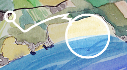
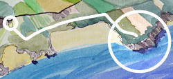
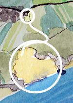
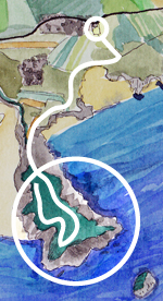
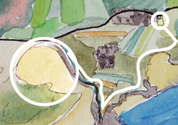
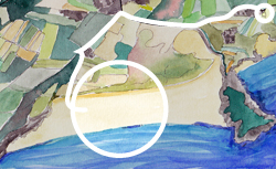
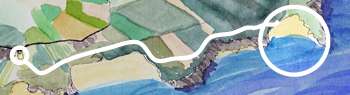
Walks from the gite : a patchwork of Brittany
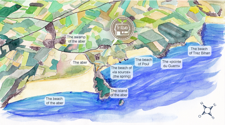
Ty Koad was born from a big crush on this area, which we would like to share with you. There, nature is wild, there are very few houses* and very few people.
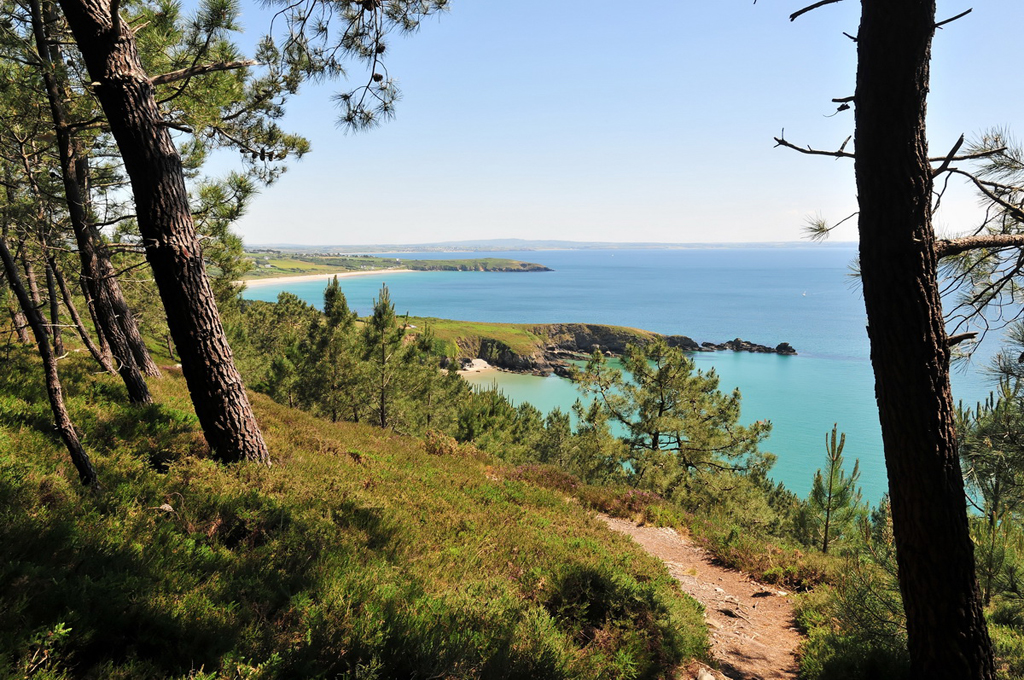
From the top of the meadow of Ty Koad, the sea appears, inviting; it is 500 meters away, as the crow flies.
We can walk to it, or ride there on a mountain bike, across fields and paths, with no roads to cross …
… Eastward, the beach of Poul (10 mn on foot), la Pointe du Guern (the headland of Guern) (20 mn), pine forests and the secretive beach of Trez Bihan (40 mn).
…Westward, the beach of the spring (10 mn) and the island of the aber (20 mn), the brook of the aber (20 mn), the swamp of the aber where fresh water and sea water mingle, overlooked by the old lime kiln (15 mn).
…Or a little farther (bicycle riding, for example), the immense beach of the aber, which surfers enjoy.
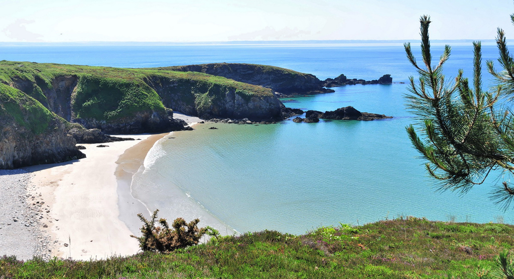
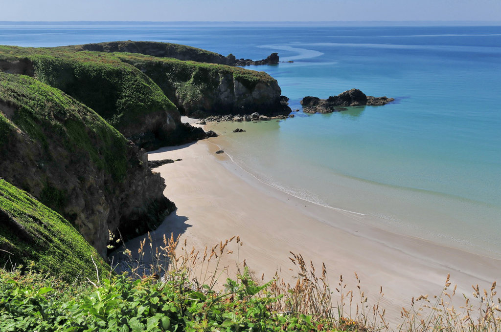
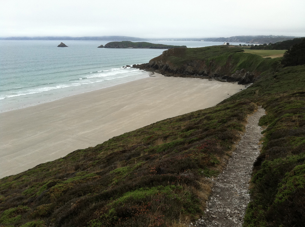
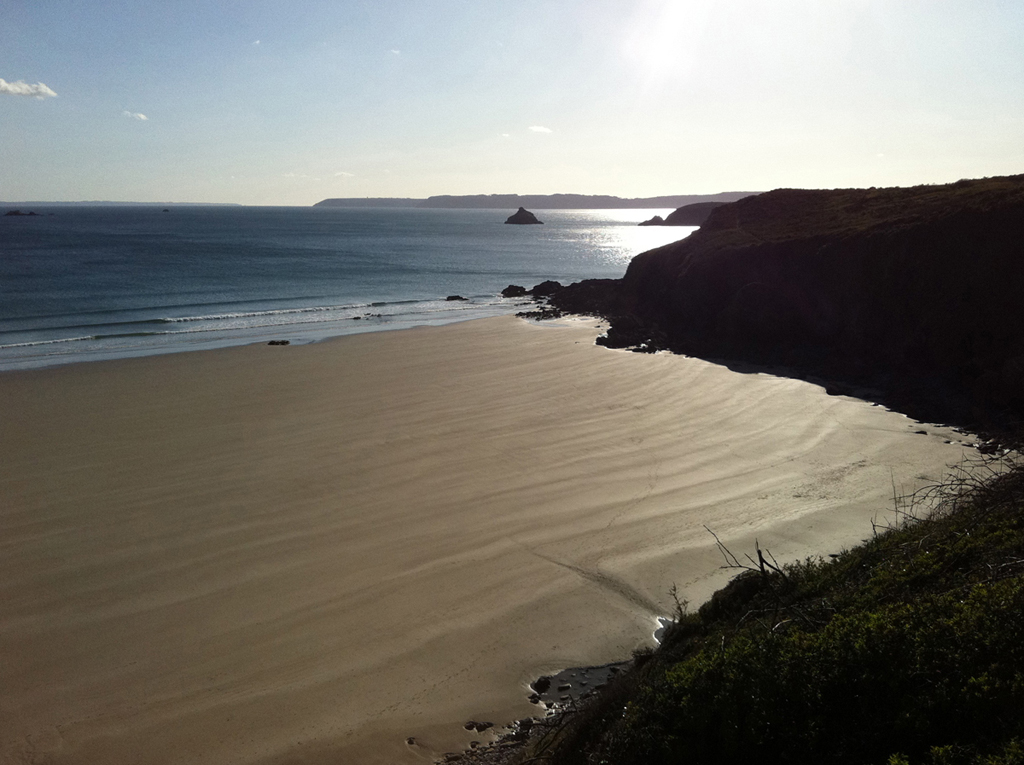
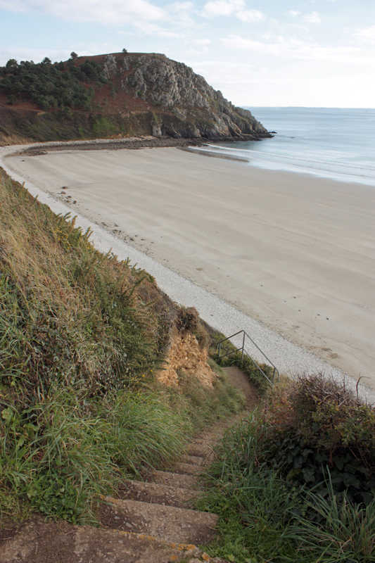
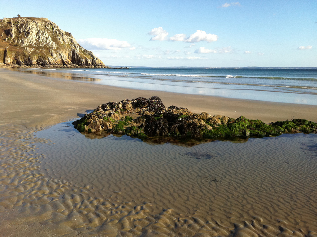
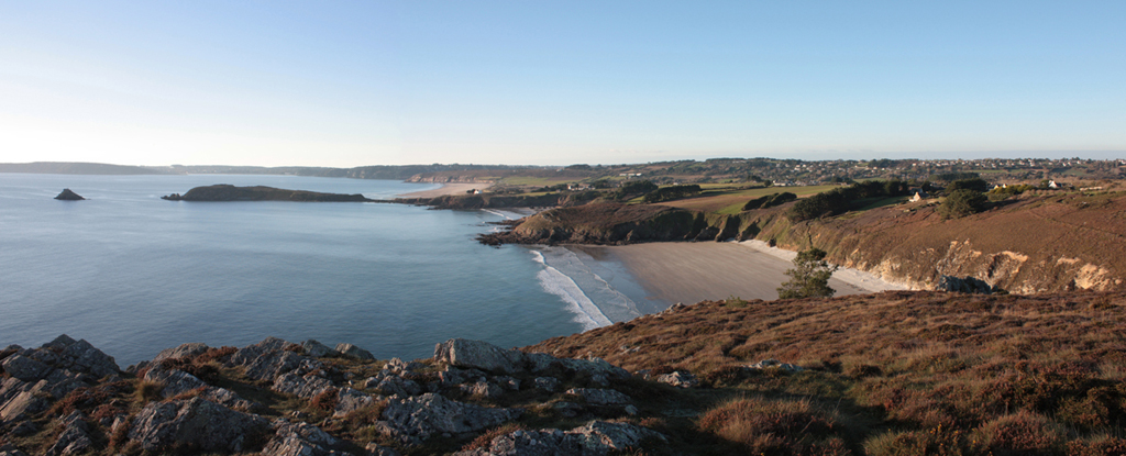
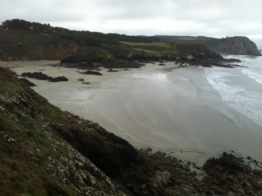
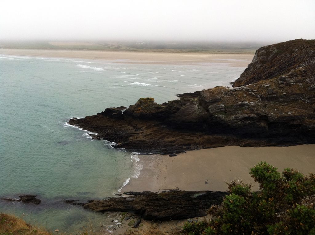
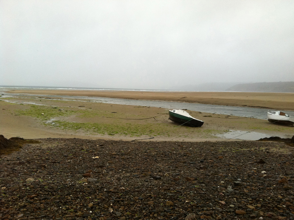
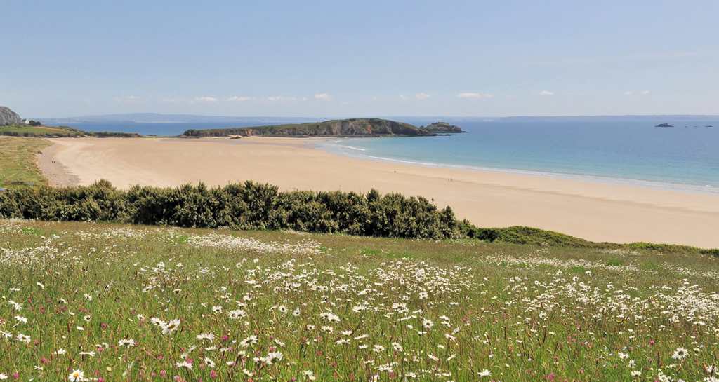
The beach of Poul
 You can hardly see it, on the gently sloping path lined with pine trees bent by the wind. Then, it suddenly pops out, at the edge of the cliff: a large expand of sand, smooth and licked by the tide (500 m long and 300m wide at low tide).To put it shortly, the war of parasols won’t be waged in a near future, even at the deepest of August. Especially as the beach should be deserved: no parking lot nearby, 101 steps carved in the cliff …

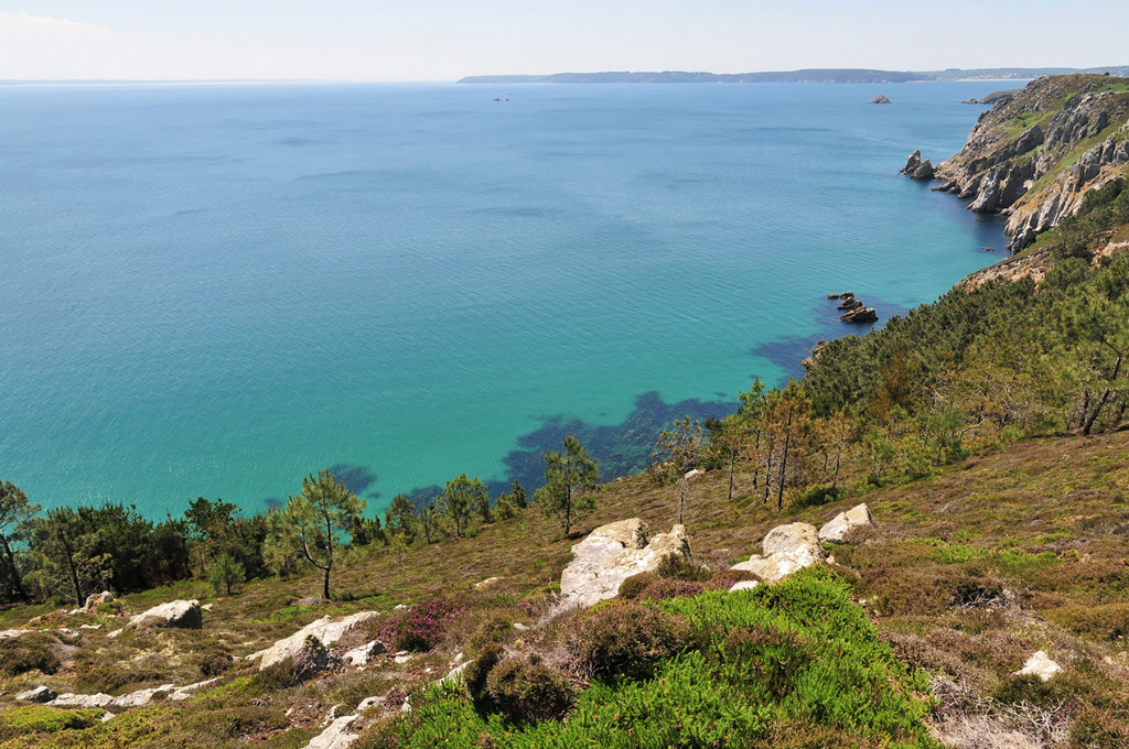
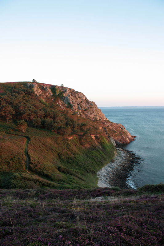
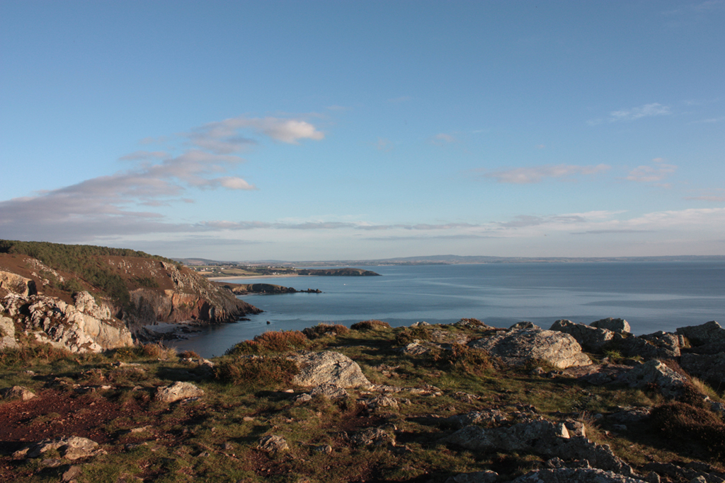
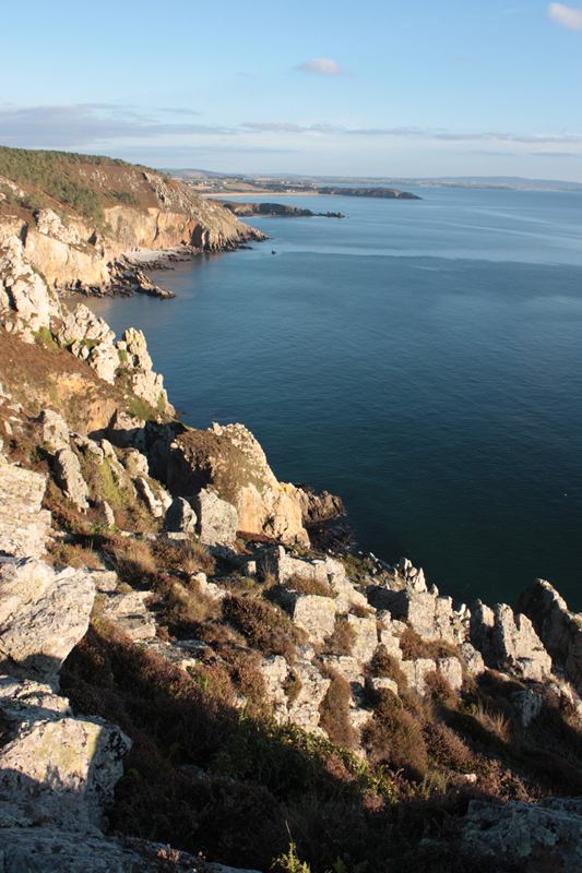
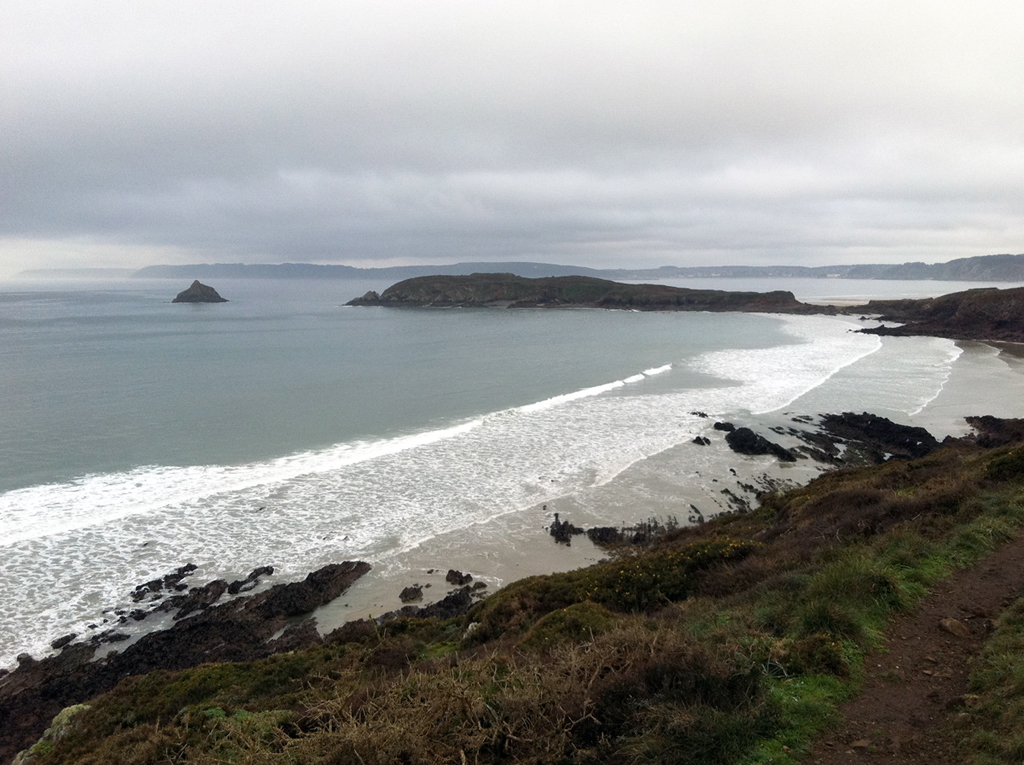
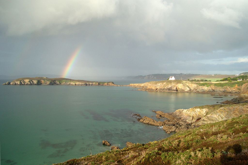
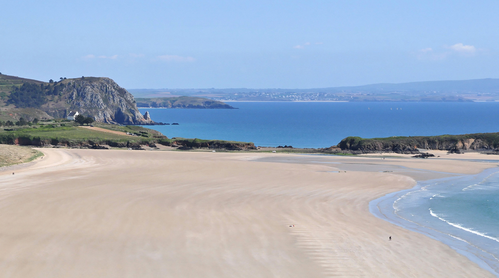
The "pointe du Guern"
 A short evening walk from the Gite, or mini-bend towards Telgruc: you can’t miss the rise to the Pointe du Guern: from there, you can see the whole vast bay of Douarnenez, which runs from the “Pointe du Raz” up to the “cap de la Chèvre” washing the ports of Douarnenez, the Porzay and the Menez Hom. It also offers downwards sights (it is more than 80 m high) on the surroundings: westward the beach of Poul, the island of the aber and its islet, the beach of the aber; eastward: Telgruc pine forests and beaches.
Kayakers can also discover it from the bottom (marine caves at the foot of the cliffs).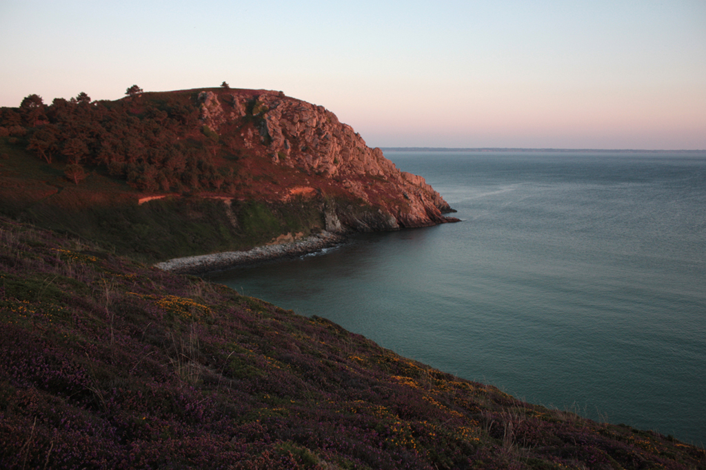
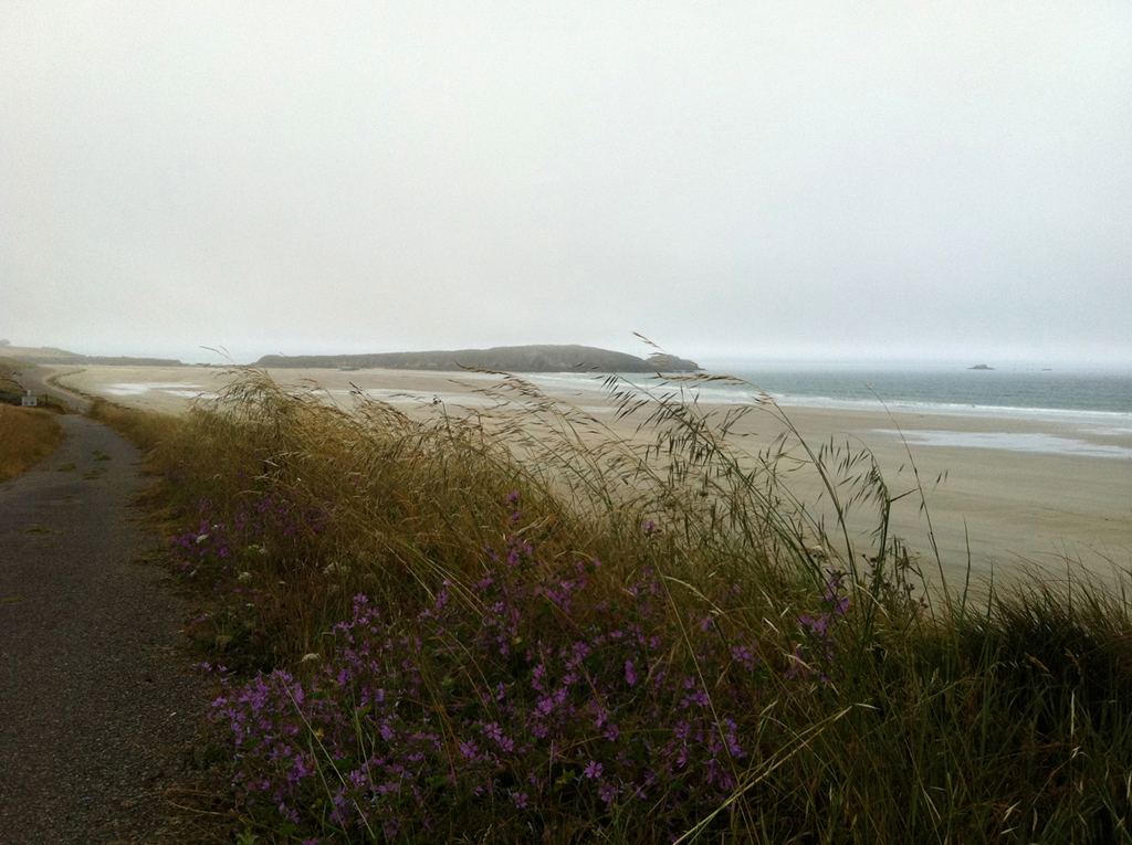
The beach of "la source" (the spring)
 It is the quickest one you can reach from the gite; by a sunken lane, almost a vegetal tunnel, you get to a menhir and, a little farther, before the hamlet of Raguenez, to the path which goes down to the beach. Smaller than the Poul’s, it almost disappears at high tide. At the edge of the beach, sheltered spaces made of sand and rocks where to put your towel.
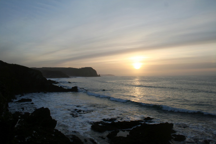
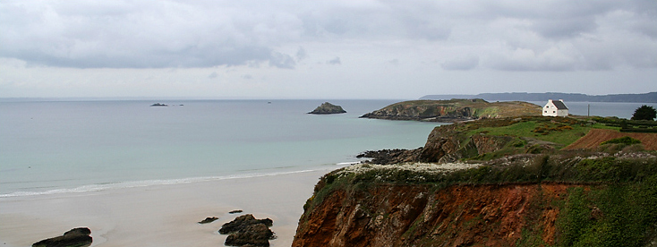
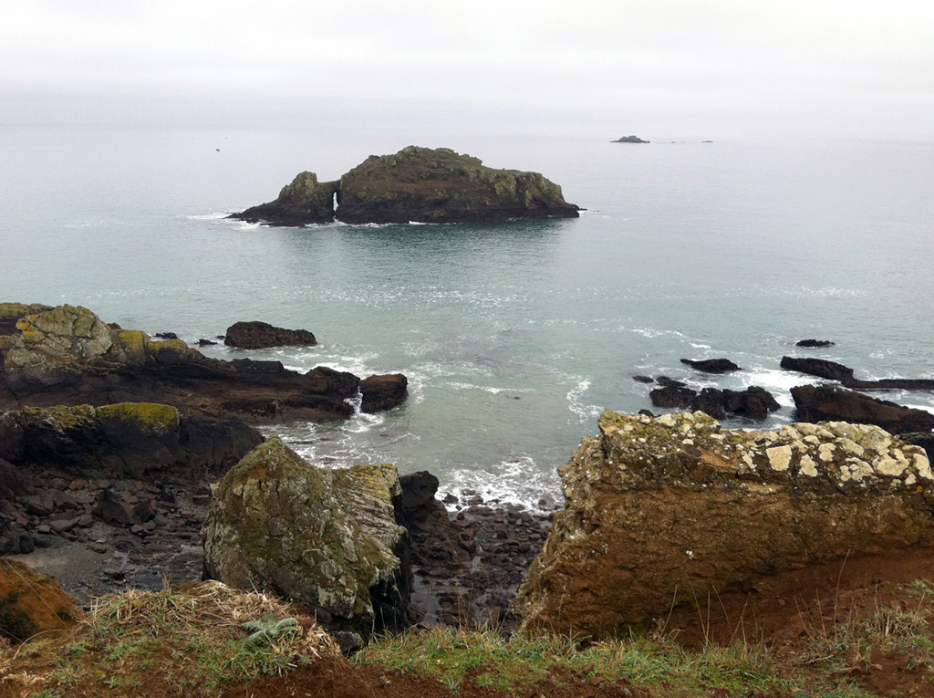
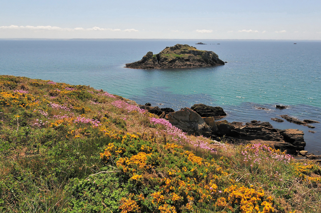
The island of the aber
 Is the island of the aber an island? Or a peninsula? The answer is changeable, twice a day... Off the island: the islet of the aber (it always remains an islet).
A quiet and spectacular walk: panoramic view on the bay and the coast. The island was fortified by Vauban, but the small fort which persists in its center is more recent (middle of the 19th century). 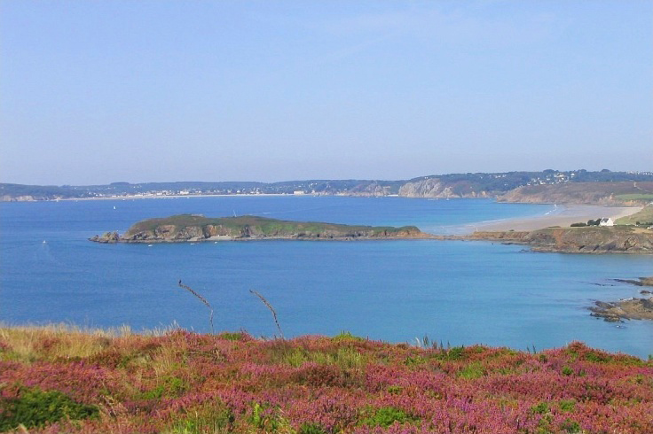
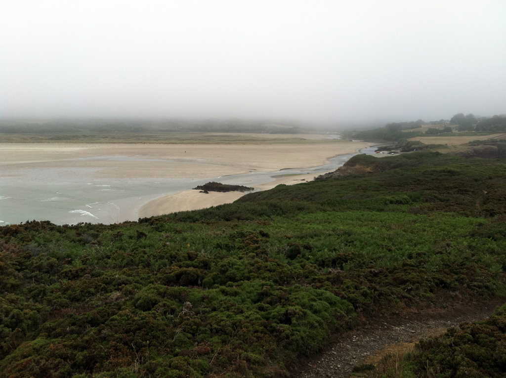
The “brook of the aber” which turns into the proper aber
 A real fresh water brook flows down the slopes of the valley, between Le Veniec road and the sea. But it changes into a sea water stream flowing (more or less strongly) up or down according to the tide.It stops you from reaching the beach of the aber on dry foot, though it is but a stone's throw away!
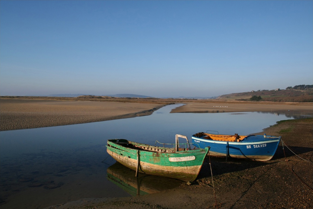
A little sheltered from the swell, thanks to the island, beaching is practiced: the moored boats float there in high tide, and wait quietly, on their sides or on stands, at low tide... Changing lights, unstable outlines, hulls of boats, mixture of big extents of sand, water and short vegetation, flight of birds… The aber is sometimes called " the Camargue of the peninsula " and shows itself an ideal place for picture hunters...


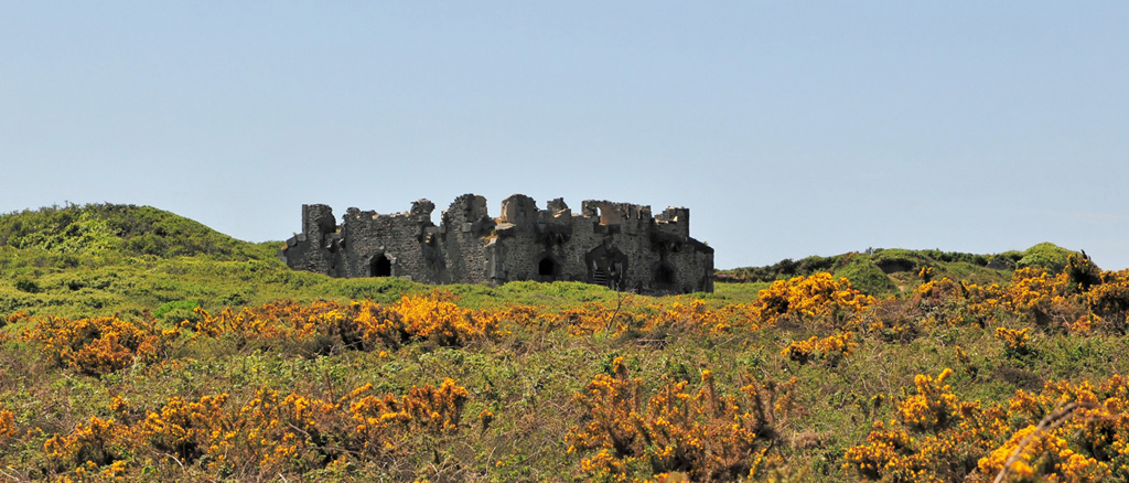
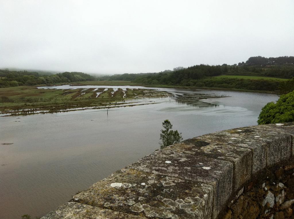
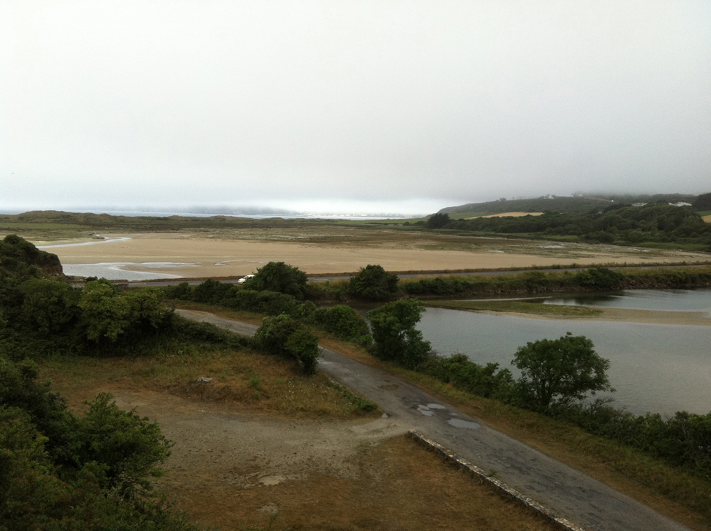
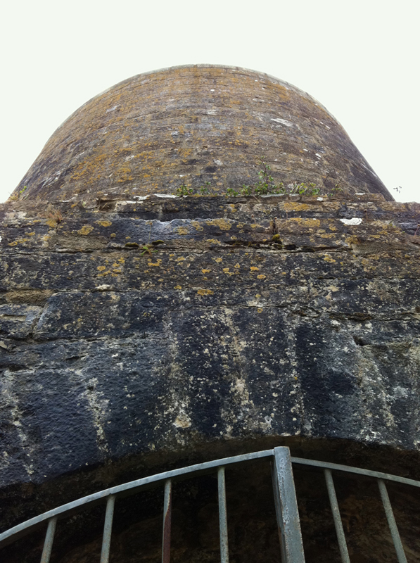
The swamp of the aber and its lime kiln
 For this stroll from the gite, it is necessary, for once, to walk on a little asphalt (but the road is quiet!). The swamp is a mixture of fresh water and sea water, closed in the South by the road-dike allowing the flow and the ebb tide in and out. In the past, the site held a village, a castle and in the middle of the 19th century a lime kiln, out of use since the beginning of the 20th. Only the walls are left (you can visit the inside on Heritage Days).
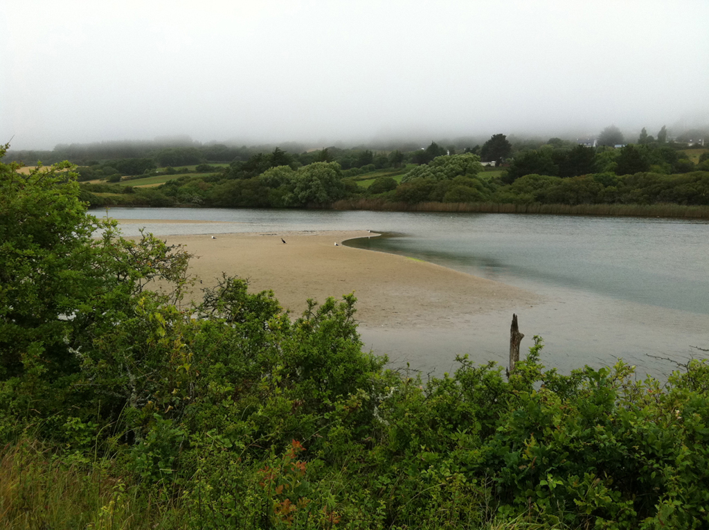
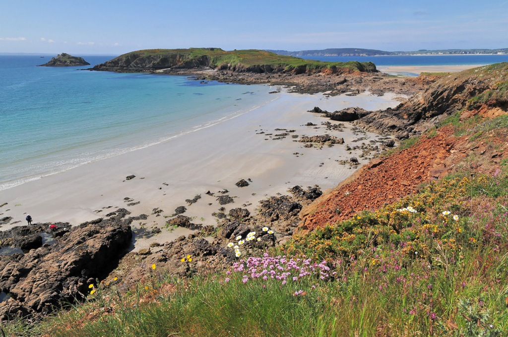
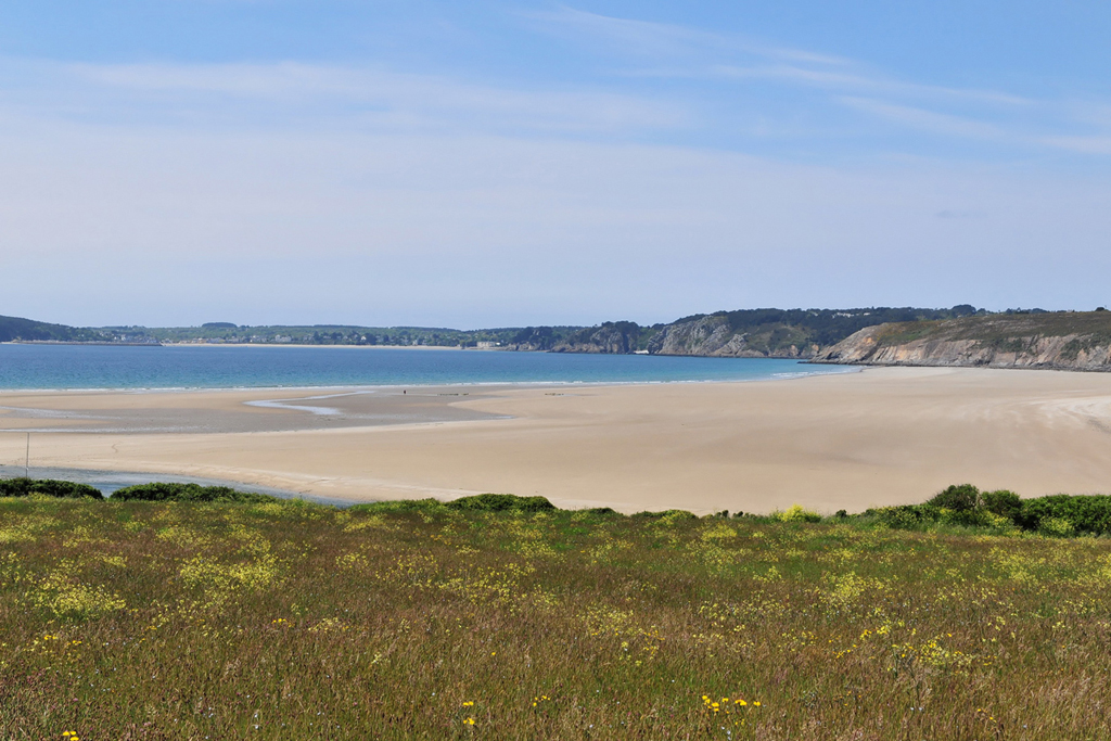
The beach of the aber
 Contrary to Poul or to La Source, this large beach is accessible, with a parking lot (not asphalted); it attracts swimmers, surfers and walkers. But no feeling of 'overpopulation', because the extent of sand is immense (1500 meters long), and it is set along the big dunes of the aber, which stresses the sensation of space.

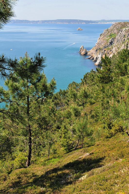
Eastward: pine forests and the beach of Trez Bihan
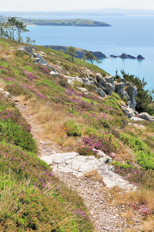
 On leaving the headland of Guern eastward, the GR 34 (path of the customs officer) follows the crest of the rocky cliffs covered with softly coloured moors; a little farther, when crossing a pine forest, it plunges towards the beach of Trez Bihan, small isolated jewel we therefore discover through branches (there again, very beautiful photos to be made).
We can walk on even farther, as far as Trez Bellec, the great touristic beach of Telgruc. The littoral path is then at the level of streams.